

Blindsided by Sydney transport? We've all been there.
Sydney transport is inconsistent, confusing and overwhelming to navigate because of a lack of transparency. There isn't enough information to help users make better decisions about their routes.
Unreliable transport
Nearly 40,000
infrastructure-related defects reported in March 2023.
Industrial action
300+
train services cancelled in a single day as strikes rise.
Inconsistent information
10%+
of bus services are missing real-time data.
A community-powered way to stay informed
The app tells Sydney commuters what is actually happening on their route, and what to do about it, with updates contributed by the people travelling it.
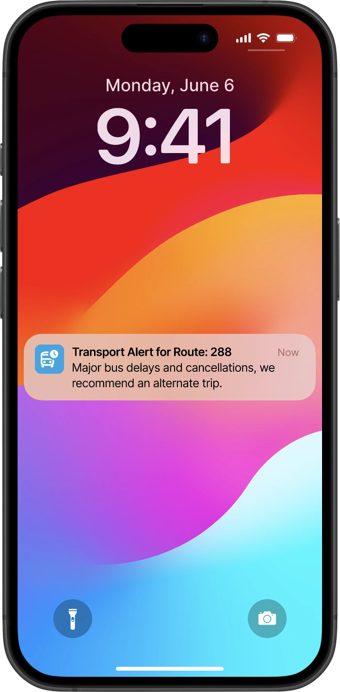
1. Real-time notifications
Notifications with automatic re-routing for any cancellations or delays, so you know about a problem, and what to do about it, before you reach the stop.
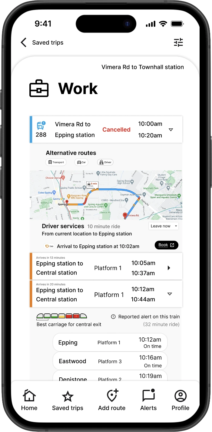
2. Automatic routes
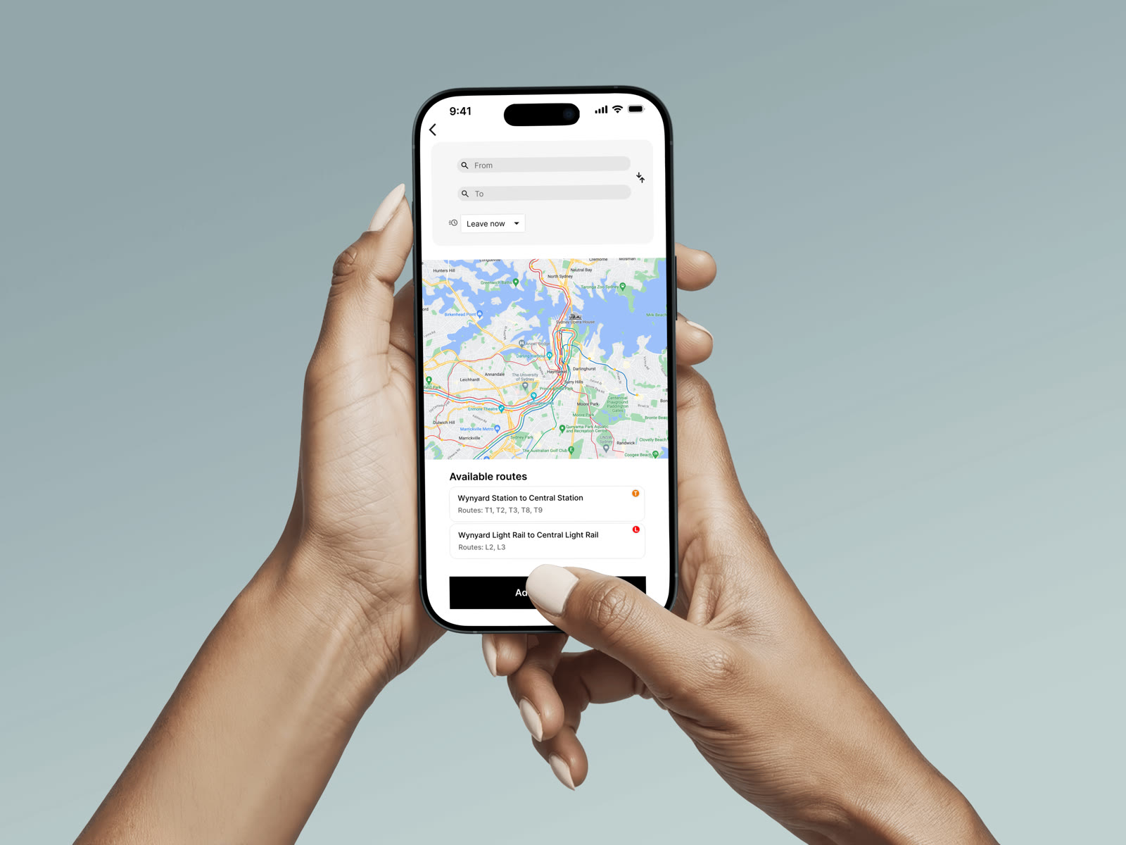
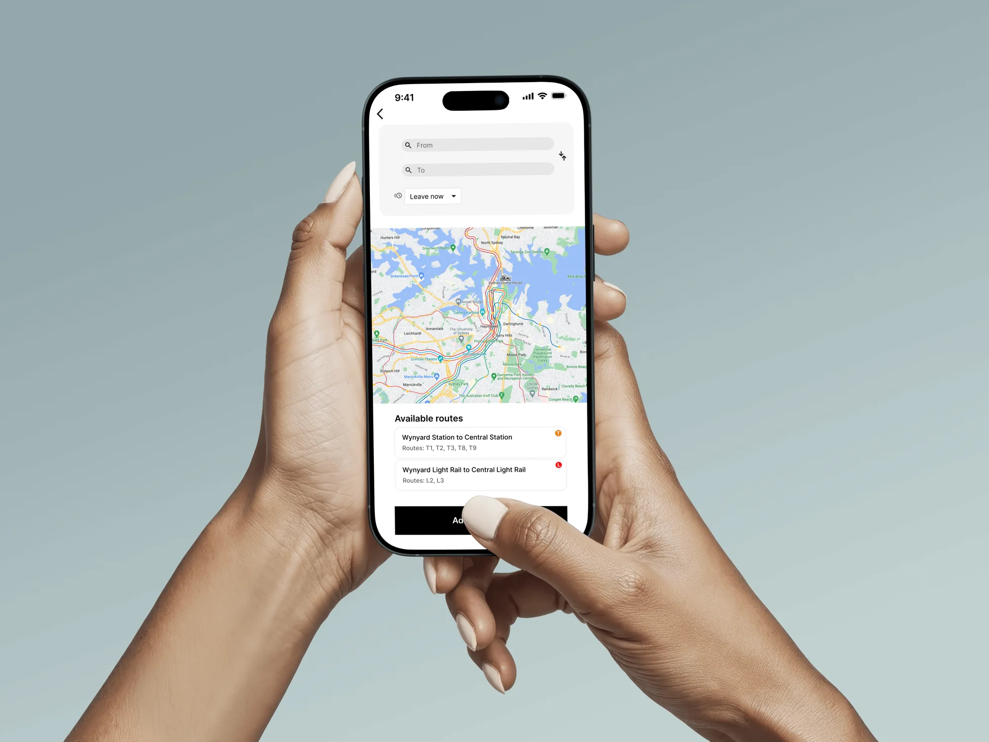
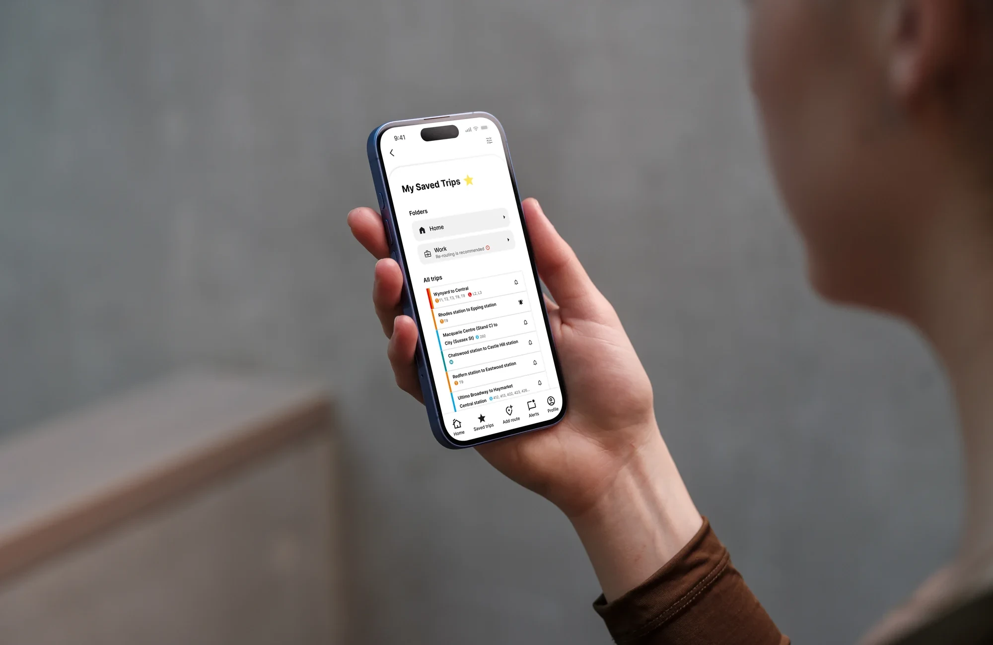
Routes are generated from your current location. Check schedules at a glance, search any destination, and save the routes you use most.
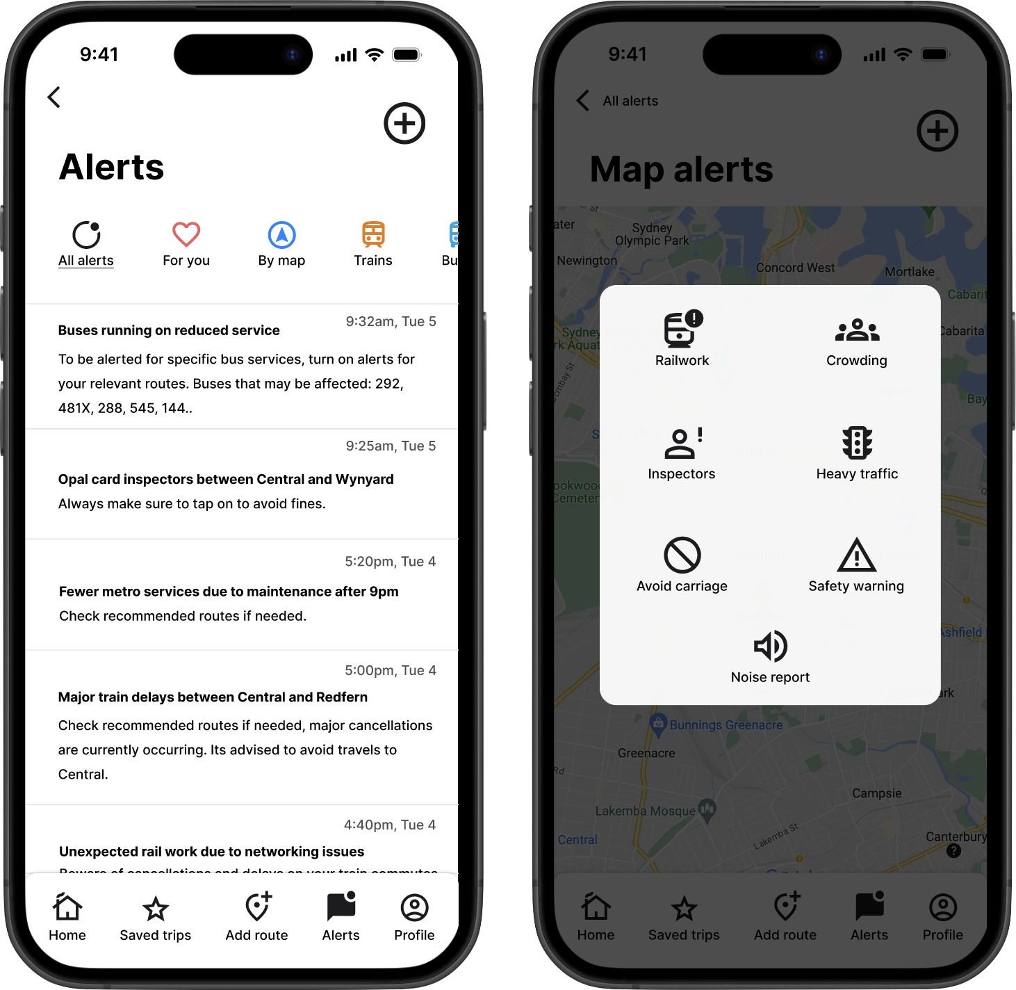
3. Community alerts
Lodge alerts to help other transport users. Every alert, from Transport NSW or the community, lives on one page that you can filter by route, transport type, or personalise.
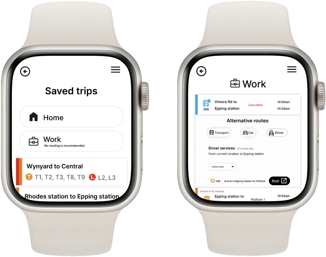
4. Apple Watch companion
Access real-time alerts discreetly on the go, without needing your phone.
What the research showed
Interviews and surveys with Sydney transport users pointed to three problems, all rooted in the same lack of transparency.
Real-time data absence
Users felt frustrated by the unpredictability of their trips. Only 10% felt informed ahead of time.
Hidden communication
Users of Google Maps and TripView found the communication and alert features hard to find.
Lack of safety assurance
Transport users expressed anxiety about using public transport without any assurance of safety.
Borrowing from Waze
The gap came from inconsistent bus data, delayed train updates and limited visibility of real-time safety concerns. Looking for apps that don't rely solely on government systems for their updates led me to Waze, a GPS app built on community input for road alerts.
The concept: a community-powered app where users contribute real-time updates, reporting sudden rail work delays, overcrowding and disruptive environments. It turns transport updates from a one-sided model into a shared network.

Low-fidelity wireframes designed w/ Balsamiq
Iterations made from testing
Usability testing and a heuristic evaluation shaped each round of screens, providing valuable insights for improvement.
1. Trip list feature
The first Welcome screen boxed every trip in a heavy outline, created a clunky visual hierarchy.
2. Search transport mode feature
Started as clunky boxes, leaving users finding the screen visually overwhelming.
Key takeaways
As my first university UX project, I felt accomplished by the designs I created. I learnt and understood the importance of user research, and centering products around their needs over aesthetics.
For future projects
Expand user testing
Run think-alouds and field studies, observing people in real transport scenarios rather than only in testing sessions.
Create more features
Explore accessibility, multi-modal route planning, and predictive alerts for service disruptions.